
No products in the cart.
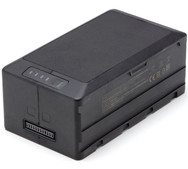
DJI MAVIC 3 ENTERPRISE SERIESYour Everyday Commercial DroneIN THE BOX!!!MAVIC 3T X1 BATTERY X1 MAVIC 3T PROTECTOR CASE X1 RC PRO ENTERPRISE X1 USB-C 100W POWER ADAPTER X1 100W POWER ADAPTER CABLE X1 USB-C CABLE X1 GIMBAL PROTECTOR X1 SCREWDRIVER X1 SET OF PROPELLERS X2 SD CARD X1The Mavic 3 Enterprise Series redefines industry standards for small commercial drones. With a mechanical shutter, a 56× zoom camera, and an RTK module for centimeter-level precision, the Mavic 3E brings mapping and mission efficiency to new heights. A thermal version is available for firefighting, search and rescue, inspection, and Centimeter-level Positioning with RTKCOMPACT AND PORTABLE 56× HYBRID ZOOM 640 × 512 PX THERMAL CAMERA 45-MIN MAX FLIGHT TIME DJI O3 ENTERPRISE TRANSMISSION CENTIMETER-LEVEL POSITIONING WITH RTK HIGH-VOLUME LOUDSPEAKERCompact and PortableStreamlined and compact, Mavic 3 Enterprise Series can be carried in one hand and deployed at a moment’s notice. Perfect for beginner and veteran pilots alike, it’s built to perform on lengthy missions.Two Models, Countless ApplicationsDJI Mavic 3EWide: 4/3 CMOS, 20MP, Mechanical Shutter | Tele: Equivalent Focal Length: 162mm, 12MP, 56× Hybrid ZoomDJI Mavic 3TWide: Equivalent Focal Length: 24mm, 48MP | Zoom: Equivalent Focal Length: 162mm, 12MP, 56× Hybrid Zoom | Thermal: DFOV: 61°, Equivalent Focal Length: 40mm, Resolution 640 × 512Premium Camera PerformanceSurvey with SpeedMavic 3E’s wide-angle 4/3 CMOS, 20MP sensor has a mechanical shutter to prevent motion blur and supports rapid 0.7-second interval shooting. Complete mapping missions with extraordinary efficiency without the need for Ground Control Points. 8cab0af7-b3e8-4779-8b7a-153c1e5489c7 Improved Low-Light PerformanceMavic 3E’s Wide camera has large 3.3μm pixels that, together with intelligent low-light mode, offer significantly improved performance in dim conditions.Focus and FindBoth Mavic 3E and Mavic 3T are equipped with a 12MP Zoom Camera, supporting up to 56× Max Hybrid Zoom to see essential details from afar.See the UnseenMavic 3T’s thermal camera has 640 × 512 resolution and supports point and area temperature measurement, high temperature alerts, color palettes, and isotherms to help you find your targets and make quick decisions.https://flyhighusa.com/wp-content/uploads/2022/10/33d50321-d7b8-4c7b-b264-8009c51a0e80.mp4 Simultaneous Split-Screen ZoomMavic 3T’s thermal and zoom cameras support 28× continuous side-by-side zoom for easy comparisons.https://flyhighusa.com/wp-content/uploads/2022/10/46a28dac-0e9c-454c-adac-3d31691b1d9c.mp4 Exceptional Operational EfficiencyBatteries Optimized For Endurancehttps://flyhighusa.com/wp-content/uploads/2022/10/73c9c2c1-a630-4d06-8b66-743337f17c77.mp445-min flight durations let you cover more ground each mission, for surveying of up to 2 square kilometers in a single flight. Max Flight Time: 45 Minutes. Surverying Area in a Single Flight: 2 Square Kilometers.Fast charge batteries with 100W charging hub, or directly charge the drone with 88W fast charging. Charging Hub: 100W, Aircraft 88W.Next-Generation Image TransmissionQuad-antenna O3 Enterprise Transmission enables more stable connections in a wide variety of complex environments.Omnidirectional Sensing for Safe FlyingEquipped with wide-angle lenses on all sides for omnidirectional obstacle avoidance with zero blind spots. Adjust proximity alarms and braking distance depending on mission requirements. Advanced RTH automatically plans the optimal route home, saving power, time, and hassle. APAS 5.0 enables automatic rerouting around obstacles, so you can fly with peace of mind.https://flyhighusa.com/wp-content/uploads/2022/10/808c22b0-571f-4bab-ae5f-f4ae4858bc7b.mp4https://flyhighusa.com/wp-content/uploads/2022/10/c7dc5681-226f-47ba-820c-9361530ef173-1.mp4Full Software SuiteDJI Pilot 2A revamped Enterprise flight interface designed to improve piloting efficiency and flight safety. Drone and payload controls can be easily accessed with one tap. Clear presentation of flight details and navigational information improves user experience together with support for various route types.DJI FlightHub 2All-in-one cloud drone operations management for your fleet with support for live annotations and cloud mapping for seamless ground-to-cloud synergy. Efficiently manage inspection operations with route planning and mission management.DJI TerraFull featured mapping software for all stages of work, from mission planning to processing of 2D and 3D models.DJI Thermal Analysis Tool 3.0Analyze, annotate, and process images captured by M3T using DTAT 3.0 to detect temperature abnormalities in your inspections.User Data SecurityLocal Data Mode | One-Tap Clear All Device Data | AES-256 Video Transmission Encryption | Cloud API
Related products

Pickup Trucks
$ 92.51
Bailey Channels | Weather Strips
$ 98.96
Bailey Channels | Weather Strips
$ 99.32